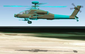
SMOTAR Aircraft

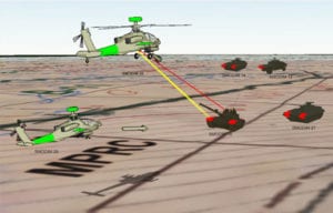
SMOTAR Vectors

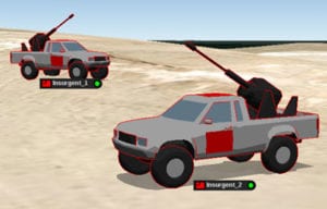
SMOTAR Trucks

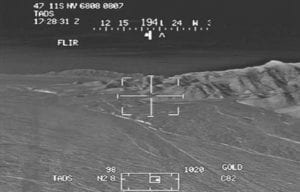
SMOTAR Video
SMODIM Tracking, Analysis and Recording (SMOTAR) advanced software suite provides a complete overview of the networked area and cooperative players in near real-time. Its interactive capability allows the user to develop training exercises, monitor live engagements, and record events for playback. Real-time data includes player Position Location (PL), heading, velocity, sensor heading, sight azimuth, weapon events, dead/alive status, Aircraft Survivability Equipment (ASE) status, and Real Time Casualty Assessment (RTCA).
SMOTAR integrates with TESS for monitoring and tracking Force-on-Force and Force-on-Target weapons training. Weapons are simulated using MILES and Geometric Pairing. SMOTAR automatically adjudicates simulated indirect fires. Command and control admin has oversight to deny fires for safety and risk mitigation during live fire training.
A customized SMOTAR Workstation can be connected to a monitor in a Tactical Operations Centers (TOC). It is ultra-rugged, encrypted, and certified to military standards.

SMOTAR Aircraft

SMOTAR Vectors

SMOTAR Trucks

SMOTAR Video
SMOTAR maintains a dynamic position database through player-to-player communications. GPS provides real-time position data as instrumented players are dynamically tracked and recorded. Player icons are displayed in 3D with color-coded team assignments and user-editable call signs. Player position and status updates are received through the telemetry network with event reports, such as weapon fire and engagement results. SMOTAR creates a 3D rendered visualization using this player position and event data.
SMOTAR integrates with the Aerial Weapon Scoring System (AWSS) that provides near real-time scoring information for attack helicopter training on instrumented ranges. The Scoring Display shows selected data collected from the AWSS interface, including aircrew and aircraft data, range to target, munition time-of-flight, target silhouettes, rocket target engagement areas, and all munition and Laser detection events. A signal to the target lifter indicates when target effect is achieved. Printed score reports are generated for each target along with a chronological list of all AWSS-specific scoring events.
The Graphical User Interface (GUI) provides easy navigation and control utilizing National Geospatial Agency (NGA) map data. Map overlays can be created, edited and independently displayed or hidden. Aircraft video is collected and imported with Pilot and CPG audio, then synchronized with playback. The user can pause, rewind and fast-forward live data feeds without interrupting recording of new data. Critical events are bookmarked and saved for playback during After Action Review (AAR).


